Drone Portfolio

UAS Pavement Evaluation

Sawyer County Airport (HYR) – Hayward
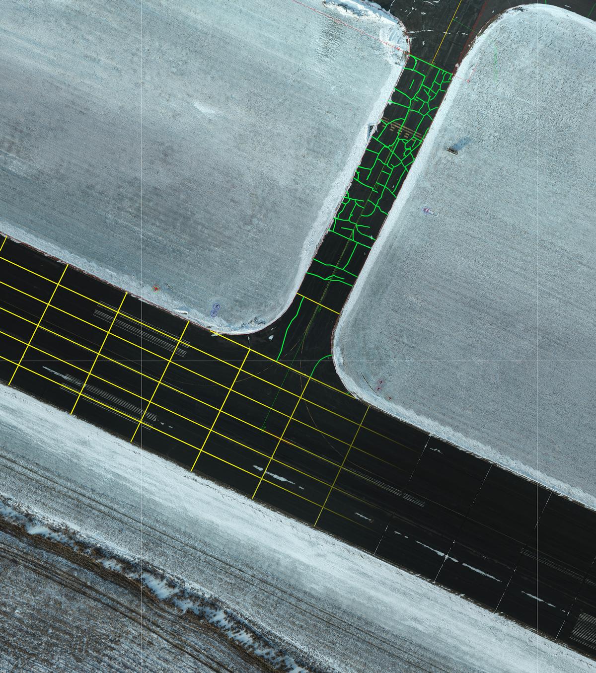
UAS Pavement Evaluation  - Sawyer County Airport (HYR) – Hayward

General Information

Becher Hoppe was selected for various projects and the Sawyer County Airport in Hayward Wisconsin.  One of these projects consisted of evaluating the pavement infrastructure and developing a plan for pavement rehabilitation to extend the pavement service life. The design and survey team use a drone equipped with a real time kinematic (RTK) GPS and a photo sensor to collect hundreds of aerial images.  The images were processed to produce an orthorectified mosaic image of the entire airport pavement surface. The orthoimage was evaluated to identify joints and pavement distresses and develop a rehabilitation plan. Project cost estimates were prepared from quantity data taken from the orthoimage.

Services Provided

  • On Field Airport Communication – The flight team consisted of a survey crew member, two FAA Part 107 Drone Pilots, one of which is also a Private Pilot, with Instrument Rating, Tailwheel and High-Performance Endorsements.  The experienced pilot is key in communicating with the airport staff and radio communications during the flight mission.  Ultimately, providing the safest flight possible for both manned and unmanned aircraft.
  • Ground Control Points – or GCPs of known locations from prior surveys were used to validate and confirm the measurements collected by Unmanned Aerial System for these flight missions.
  • Topographic Survey – Raw data was collected of the site utilizing a drone equipped with real time kinematic (RTK) GPS equipment.  A digital terrain model was then generated utilizing the corrected GPS images and photogrammetry.
  • Ortho Imagery - ALong with the digital terrain model, the team also generated a current orthorectified image of the site that aided in the anaysis of the existing pavement conditions.